
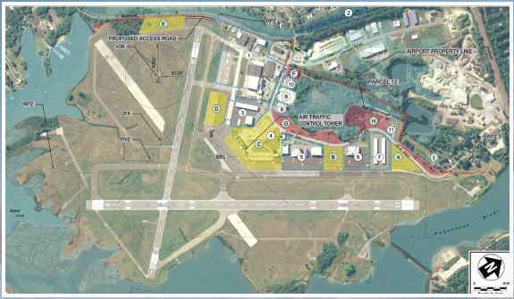
Development Opportunities of the Groton-New London Airport
The prepared diagram and accompanying table depict available areas for development and potential uses. Detailed descriptions including the area, existing topography, and the availability of utilities, among other characteristics have been prepared for individual parcels and can be made available by contacting the CAA.
Development Considerations
- FAA Airport Design Standards
- FAR Part 77
- Federal Obligations
- Site Topography
- Utility Availability or Constraints
- Ground and Airside Access
- Compatible Land Use
- Environmental Impacts
| Parcel | Current Use | Recommended Use |
|---|---|---|
| A | Open Space | Aviation – Hangars |
| B | Open Space | Aviation – Hangars |
| C | Terminal Parking, & Ramp | Aviation – Hangars** |
| D | Tie-downs | Tie-downs or Hangars |
| E | Open Space | National Guard |
| F | Wooded | National Guard |
| G | Open Space | Aviation or Non-Aviation Development |
| H | Open Space | Aviation or Non-Aviation Development |
| I | Open Space | Aviation or Non-Aviation Development |
| Note: Numbered parcels represent existing airport leaseholds. **Indicates space is no longer available. | ||